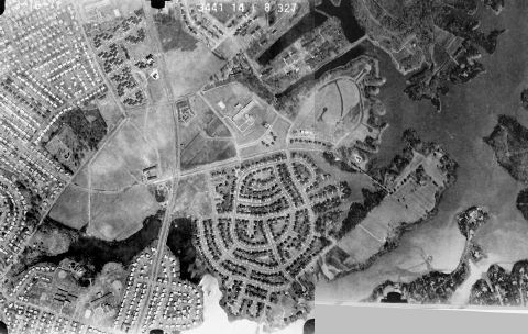
| Pembroke Meadows development begins to
take shape in this 1967 aerial photo looking to the Southwest. Old
Donation Farm still fills most of the area and the streets in Pembroke
Meadows are barely scratched out and unpaved. You can see that Aragona
Village and Pembroke Mall are fully developed. Pembroke Shores is
yet to be.
Note: The available PDF files
are large and may take several minutes to download. Be patient.
All photos have significant detail. Use the magnification tool to
zoom in for a closer look. |
|
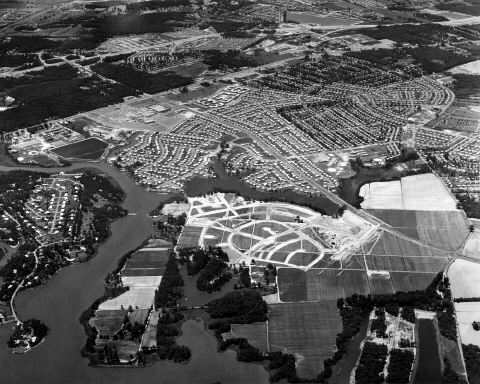
Photo: Fariss Pictures,
Inc.
|
|
Click
Here to see a larger image in pdf format with Labels
|
|
Click
Here to see a larger image in pdf format (no labels)
|
| After Pembroke Boulevard was paved, the
original gazebo and the brick entranceway gates were built. On the
right are the Pembroke Meadows model homes on Whitechapel Court.
The field on the left is where Safeway (now Food Lion) and Pembroke Meadows
Shopping Center was built.
(You may click on the
photo to see a larger image in pdf format.)
|
|
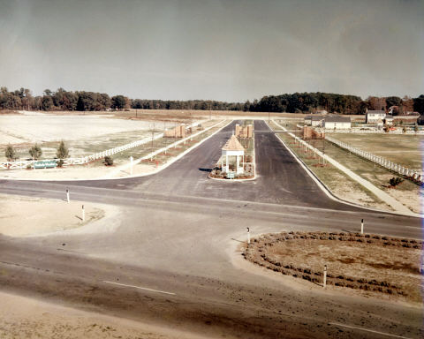
Photo: Fariss Pictures,
Inc.
|
| In front of the Pembroke Meadows model
homes, across Whitechapel Drive, was a man-made lake with a replica of
a mill with water wheel. This view is looking Southwest toward Independence
Boulevard and the culverts over Lake Pembroke. Part of the medical
plaza sits here today.
(You may click on the
photo to see a larger image in pdf format.)
|
|
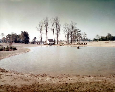
Photo: Fariss Pictures,
Inc.
|
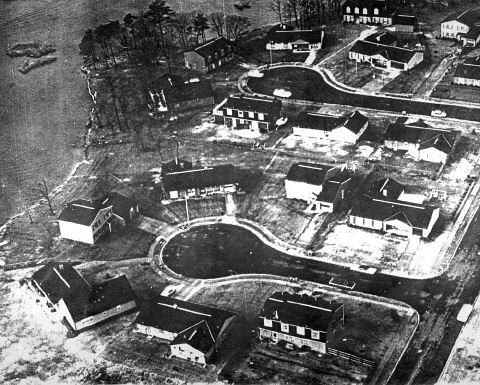
| This undated copy of an aerial photo shows
homes on Cardiff Road (back) and Sheffield Court (near) that have been
completed and occupied or still under construction. Lake Pembroke
is on the left and Sheffield Drive is on the right. All six Pembroke
Meadows and Shores home models are representend here. From bottom
right clockwise around the circle:
Chesterfield,
Gloucester,
Fairfax,
Westover,
another Gloucester, another Westover and Lancaster.
The center house on Cardiff Road is a rear view of a Sussex.
(Click on the model name to see a front view and floor plan.)
(You may click on the
photo to see a larger image in pdf format.)
|
|
|
| This satellite photo from March 16, 1971
shows a completed Pembroke Meadows and the first homes under construction
in Pembroke Shores. Pembroke Meadows Elementary School has been built
and also the PMRC Pool. You can see the new model homes on Saint
Mark Court and new houses on Saint Albans Street. Pembroke Meadows
Shopping Center, Giant Square and Bayside Hospital are still open fields.
(You may click on the
photo to see a larger image in pdf format.)
|
|
|